
This project introduced the process of image interpretation using aerial or satellite imagery. The task entailed identifying a site of significance using Google Earth Pro, digitising features of historical or archaeological interest and using this information to detail the significance of the site.
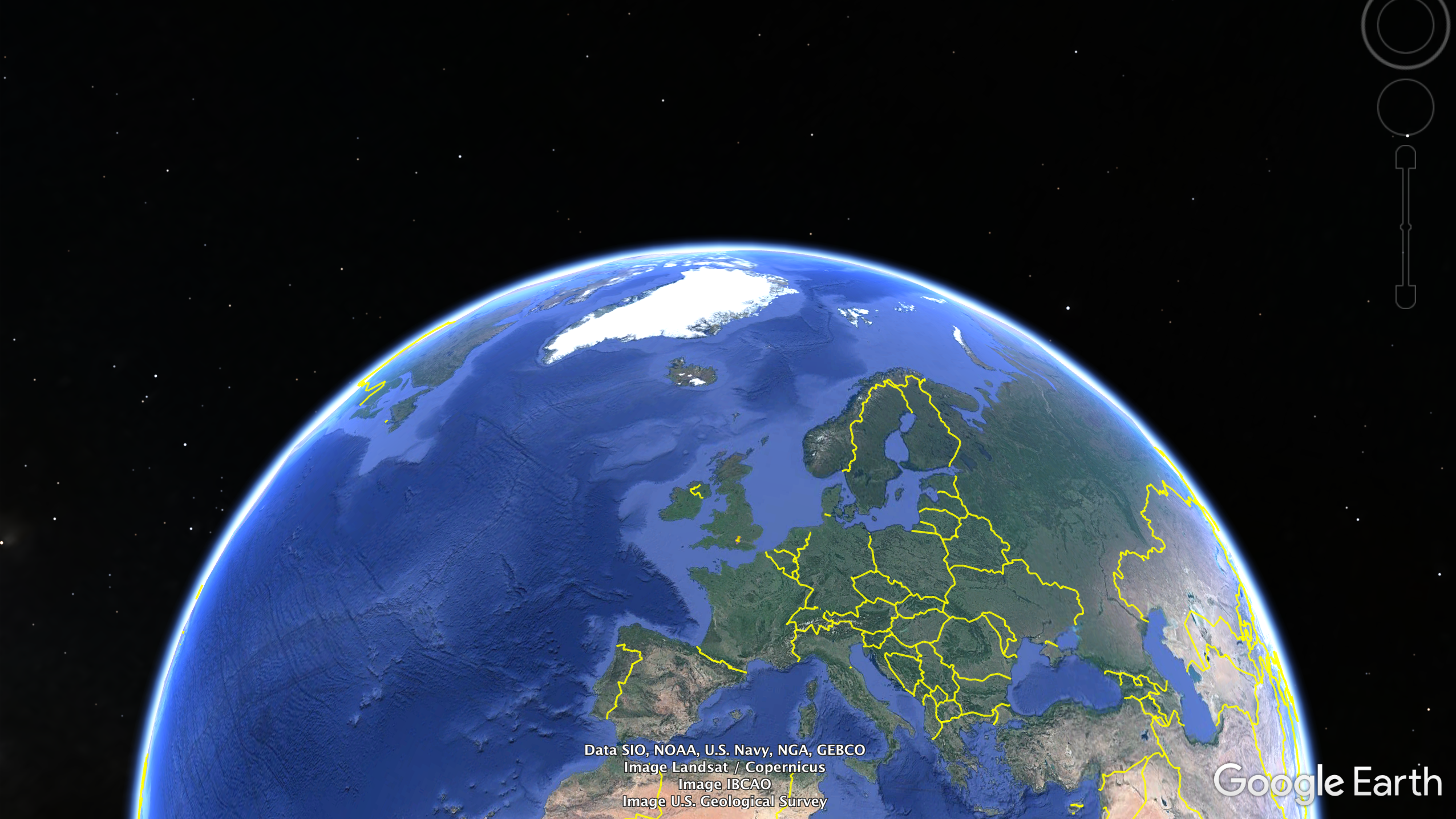
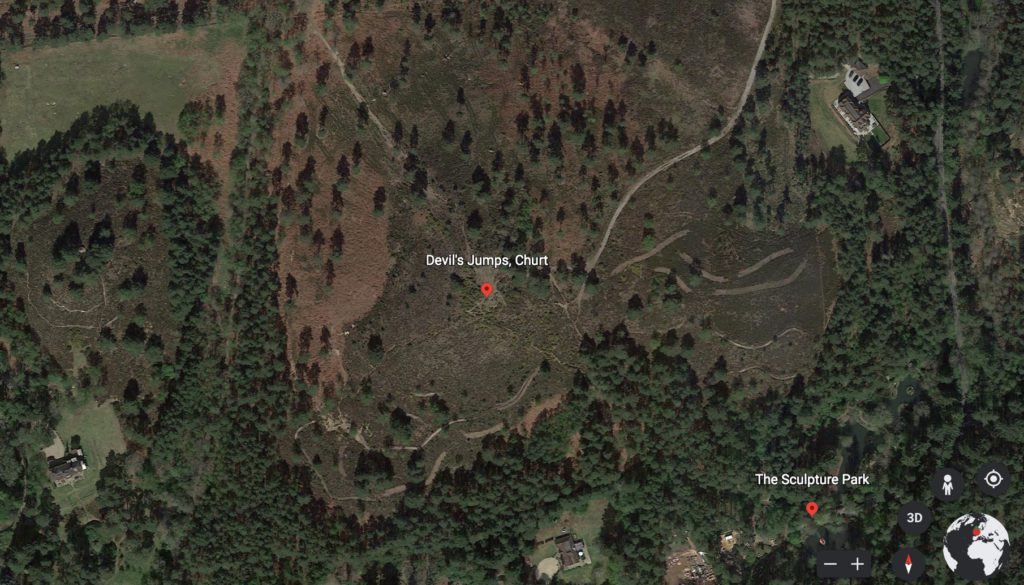
The Devil’s Jumps are a collective of naturally created conical hills, located in Churt, Surrey and form part of the Thursley, Hankley and Frensham Commons Site of Special Scientific Interest (SSSI). As an area which has generally flat and sand based land, the site is considered a natural anomaly because the Jumps are between 112-413ft tall. Satellite imagery in Figure 1 demonstrates this.
Beyond its’ designation as an Area of Outstanding Natural Beauty, ‘Middle Jump’ has unique historic significance. Nineteenth-century British Astronomer, Richard Carrington, had an observatory on the hill and discovered the existence of solar flares from it. Satellite imagery fails to depict detailing of his changes to the land due to tree canopies; this included the addition of a telescope, which has since been removed but has left a considerable collapsing of soil at the top of the hill. This limitation is significant as the site appears unchanged overtime from free and accessible satellite imagery. Moreover, as the hill is privately owned, the Google Earth ‘street view’ feature is not available; this evidences the limitations of open source software, as the accessibility of this data is privileged to locals. Software such as LiDAR (Light Detection and Ranging) would be better suited to interpreting this site. LiDAR uses remote detection technology, such as lasers, which create a digital image of an area; this software would generate an accurate understanding of the land beneath the canopies.
Using Google Earth Pro to mark points of significance and creating a legend to represent these points, scaled images of the site have been produced, over twenty-two years. The same scale has been used to demonstrate changes in the site over time.
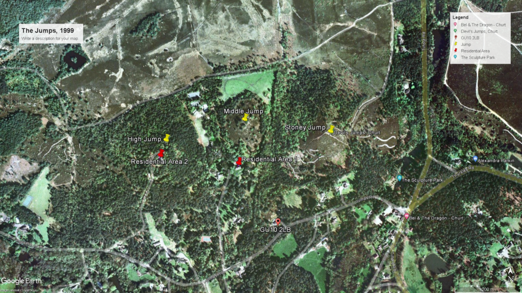
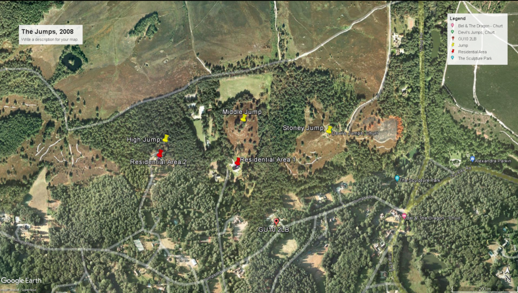
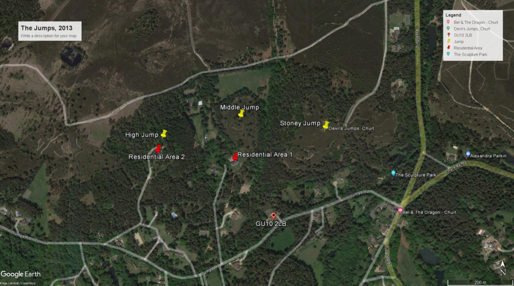
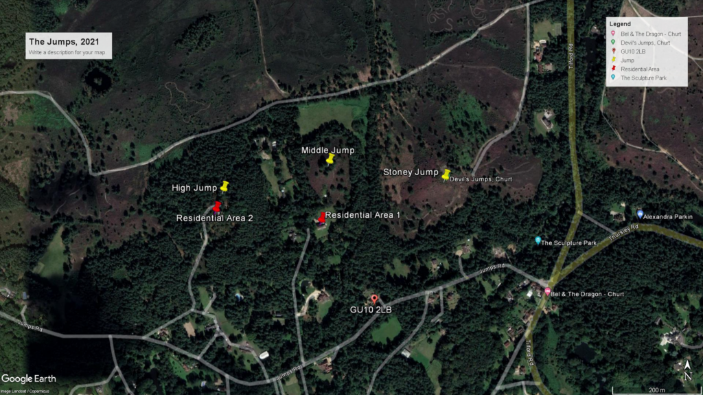
The most notable difference is in the quality of the satellite imagery. The primary take from these images is that the geography of the site has remained largely unchanged from 1999-2021. More nuanced interpretations of the site cannot be assessed from these images.
What the satellite images fail to show are significant topographical features of the site. Local knowledge supplements this limitation, as do photographs from ground level (seen in in Figures 6, 7 and 8), which assists interpretations.
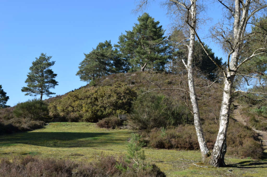
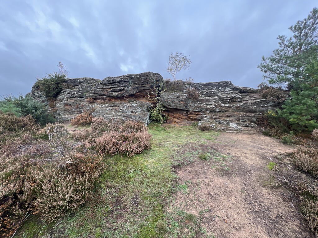
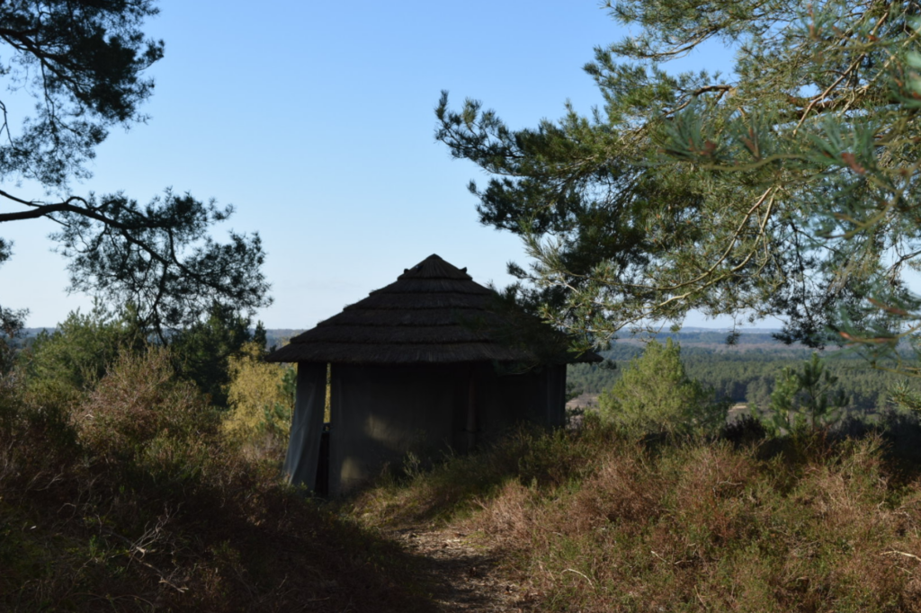
What these images show, which open access satellite imagery cannot, is the following:
- Heather dominates the Commons’ landscape
- Exposed rocks prominently point out of the third Jump, nicknamed ‘Stoney Jump’
- Middle Jump has a wooden hut, which was added within the last twenty years
These interpretations are significant as they require additional research due to insufficient information provided by Google Earth Pro. This research also revealed that the site is home to protected wildlife, including reptiles and birds. Other supplementary information of the site lies in Folklore. This depends on local knowledge and ties the Jumps with other areas within Surrey, including the Devil’s Punchbowl and the town of Thursley. This folk tradition is a form of oral history, in which traditional beliefs and stories created by the community have been passed through the generations.
Further information on Richard Carrington and the Jumps can be found using the links below:
http://www.solarstorms.org/SCarrington.html
https://www.surreycc.gov.uk/culture-and-leisure/history-centre/marvels/discovery-of-sunspots
https://www.americanscientist.org/article/sunspotting
https://www.woodlandtrust.org.uk/visiting-woods/woods/stony-jump/
https://www.arc-trust.org/stony-jump
Citations for all research in this section can be found under the ‘References’ menu